Paintings, Prints, Drawings & Photographs Victoria Area
Logout
LoginSign up
Place Ad Newsletter Signup
Paintings, Prints, Drawings & Photographs Victoria Area

$470 · 1794 Accurate Map Of Great Britain, France & Ireland, Spain, Germany, Denmark

1794 Accurate Map Of Great Britain, France & Ireland, Spain, Germany, Denmark image 1
1794 Accurate Map Of Great Britain, France & Ireland, Spain, Germany, Denmark image 2
1794 Accurate Map Of Great Britain, France & Ireland, Spain, Germany, Denmark image 3
1794 Accurate Map Of Great Britain, France & Ireland, Spain, Germany, Denmark image 4
1794 Accurate Map Of Great Britain, France & Ireland, Spain, Germany, Denmark image 5
1794 Accurate Map Of Great Britain, France & Ireland, Spain, Germany, Denmark image 6
1794 Accurate Map Of Great Britain, France & Ireland, Spain, Germany, Denmark image 7
1794 Accurate Map Of Great Britain, France & Ireland, Spain, Germany, Denmark thumbnail image 1
1794 Accurate Map Of Great Britain, France & Ireland, Spain, Germany, Denmark thumbnail image 2
1794 Accurate Map Of Great Britain, France & Ireland, Spain, Germany, Denmark thumbnail image 3
1794 Accurate Map Of Great Britain, France & Ireland, Spain, Germany, Denmark thumbnail image 4
1794 Accurate Map Of Great Britain, France & Ireland, Spain, Germany, Denmark thumbnail image 5
1794 Accurate Map Of Great Britain, France & Ireland, Spain, Germany, Denmark thumbnail image 6
1794 Accurate Map Of Great Britain, France & Ireland, Spain, Germany, Denmark thumbnail image 7

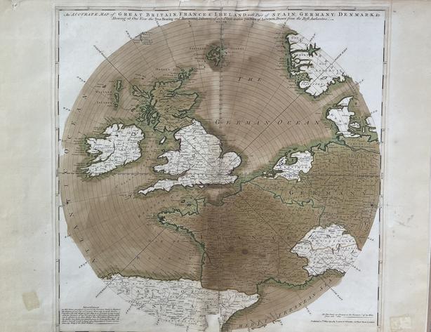
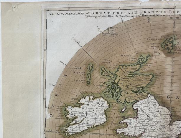
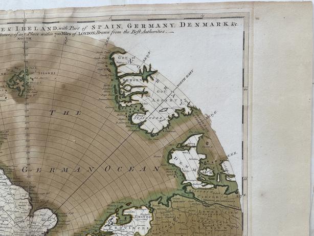
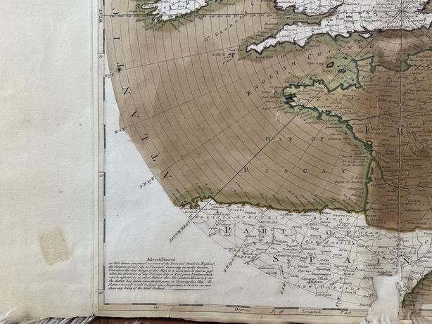
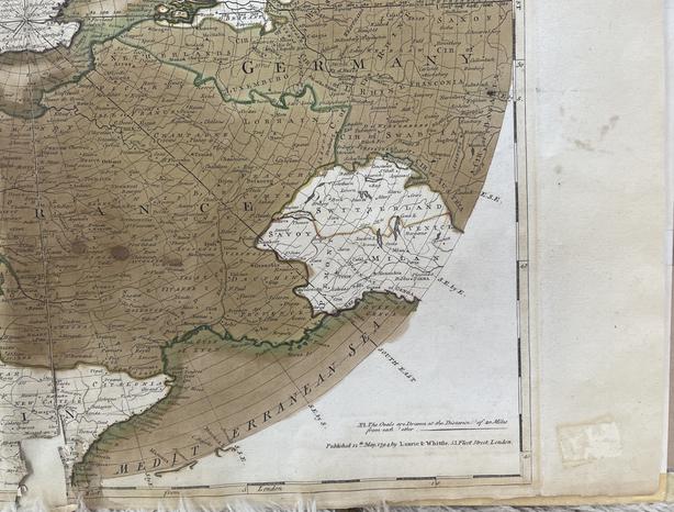
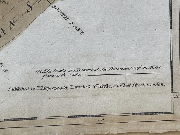
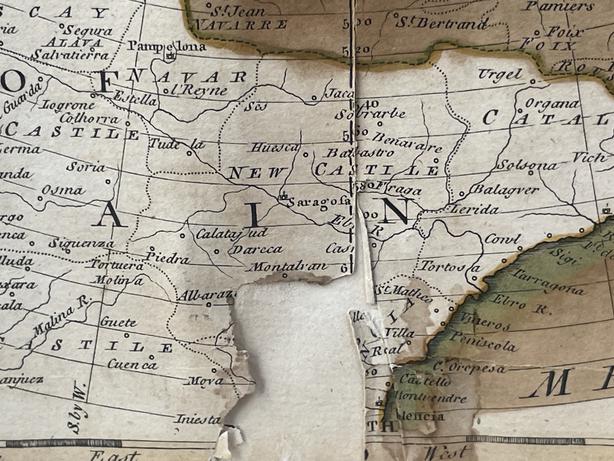
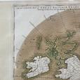
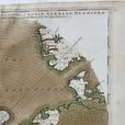
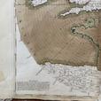
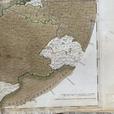
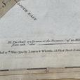
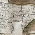
Antique Map - 1794 Laurie & Whittle -An Accurate Map Of Great Britain, France & Ireland With Parts Of Spain, Germany, Denmark. - Unframed. Travel back in time with this stunning Antique Map from 1794 by Laurie & Whittle. This intricately detailed map showcases Great Britain, France, Ireland, Spain, Germany, Denmark, and surrounding seas with precision and accuracy. Perfect for history buffs, collectors, or anyone with a love for vintage cartography. This unframed map is a in fair condition given it’s age. It does have some losses and tape residue. The Map has been hand painted and captures the essence of 18th-century navigation and geography. Add a touch of elegance to your home or office with this timeless piece of art. Don't miss out on owning a piece of history - order yours today from our online store. Shipping within Canada and the Continental United States is complimentary with purchase. Please feel free to reach out with any questions.

Ad #
41142619
Posted
August 7, 2025
Expiry
September 6, 2025
Status
NOT SOLD
Details
Commercial Seller
Category
  • Phone
Email User
Last hour
Last 24 hours
Total
Views
0
1
9
Browsed
0
13
122
Contact User
VintageMayhem profile image
Email User
Email User